Auction: 15040 - Antique Maps sale during the International Exhibition
Lot: 166
Maps
Africa
North Africa
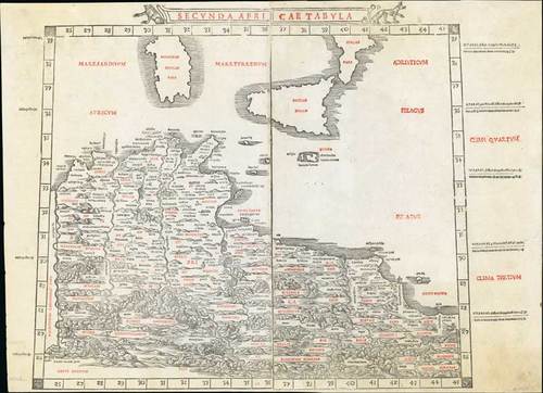
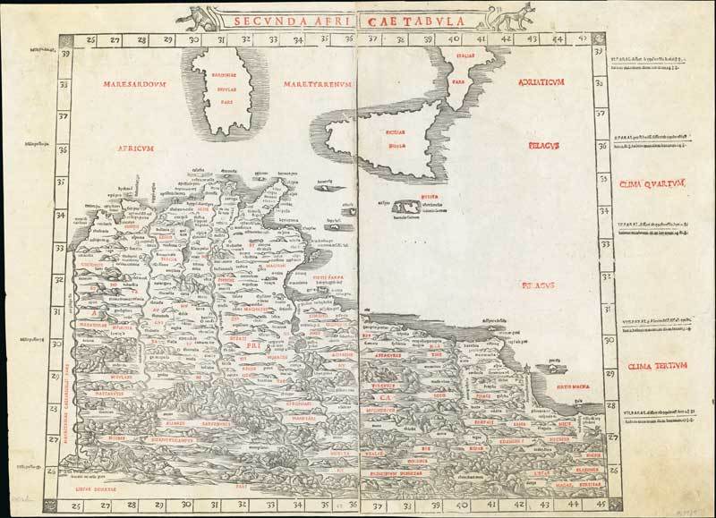
1511 Secunda Africae tabula by Bernado Silvani based on Ptolemy; 21½ x 15½ inches, printed in two colours.
Sylvanus' map of part of Tunisia, Lybia, Sicily and Sardinia is one of the earliest obtainable maps of the region and the first printed in two colours. The map appeared in Sylvanus' "Claudii Ptholemaei Alexandrini liber Geographicae ...", published in Venice in 1511. The Sylvanus edition of Ptolemy is one of the earliest to include maps with modern geographical updates.
Printed in two halves, this has been skillfully joined. Exceptionally fresh and fine. Photo
Estimate
SG$3,000 to SG$3,500

Watch, listen and bid as if you were in the room. Now available for auctions worldwide.
Click here to bid live
An exclusive and confidential service for the discerning collector or vendor.
View the Gallery
Download every Spink catalogue on your iPad, iPod or iPhone using free Spink app.
Download From iTunes© 2026 Spink & Son. All rights reserved.