Auction: 15040 - Antique Maps sale during the International Exhibition
Lot: 167
Maps
Africa
Egypt
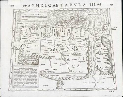
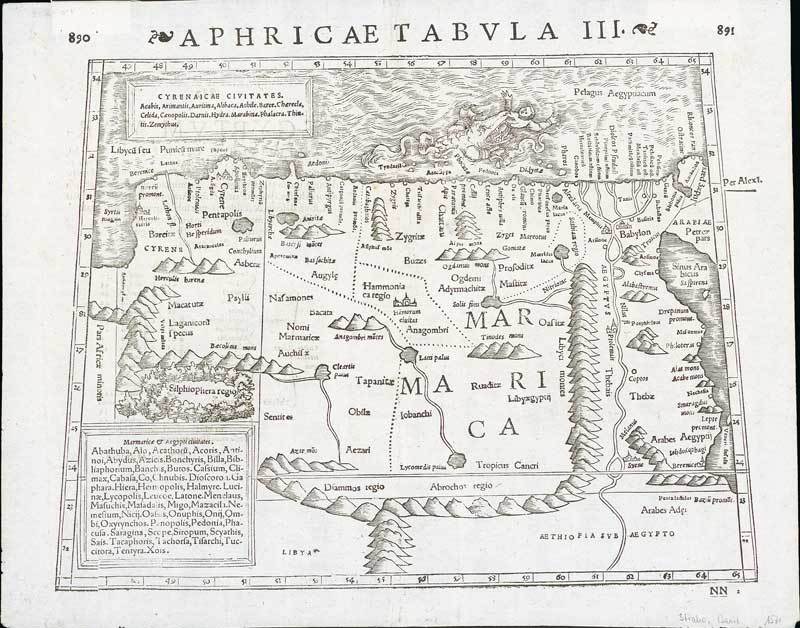
1542 Aphricae Tabula III by Sebastian Munster; 15 x 12 inches, uncoloured. Pages numbered 890 and 891 with Latin text on verso. Printed on laid paper.
A highly decorative map of the region from the Libyan Sea to the Red Sea, including Babylon, Thebes, the Pillars of Hercules, Hanorum, Alexandria, Memphis, and many other classical places. The Nile has its origin in Aetheopia Sub Aegypto. Interesting scene at top of a man being swallowed by a sea monster. The map is based upon classical Ptolemaic information. The map is unchanged from the 1540 edition. Munster's Geographia was a cartographic landmark, including not only Ptolemaic maps, but also a number of landmark modern maps, including the first separate maps of the 4 continents, the first map of England and the earliest obtainable map of Scandinavia. Munster is generally regarded as one of the three most important map makers of the 16th Century, along with Ortelius and Mercator. He issued his first mapping of Germany in 1529, after which he issued a call for geographical information about Germany to scholars throughout the country. The response was better than hoped for, and included substantial foreign material, which supplied him with up to date, if not necessarily accurate maps for the issuance of his Geographia in 1540.
Two paper mounts on the reverse in the top margin; very fresh and fine
Estimate
SG$400 to SG$500

Watch, listen and bid as if you were in the room. Now available for auctions worldwide.
Click here to bid live
An exclusive and confidential service for the discerning collector or vendor.
View the Gallery
Download every Spink catalogue on your iPad, iPod or iPhone using free Spink app.
Download From iTunes© 2026 Spink & Son. All rights reserved.