Auction: 15040 - Antique Maps sale during the International Exhibition
Lot: 165
Maps
Africa
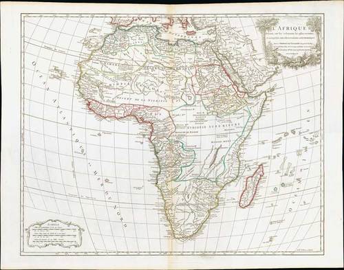
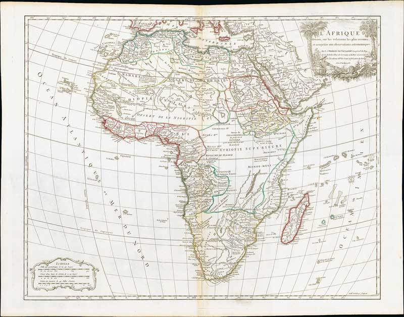
1756 L'Afrique, Dressee Sur Les Relations Les Plus Recentes ..., by G. Robert de Vaugondy; 26 x 20½ inches, original outline colour.
Copper plate engraving on laid paper. Attractive title cartouche with female native resting under two palm trees with recumbent lion at her feet. The 1756 edition of "Atlas Universel" carried this map of Africa which was based on a work of 1749. This example was published by Delamarche, with the Vaugondy's title of Geographe Ord Du Roy removed to follow revolutionary correctness. It has the additional engraving of Riebeks Castel, Constantine, Stellenbos, Drakensteen and Eaux Chauds. The map shows clearly how little was known of the interior at this time.
Usual central reinforcement, "Afrique" printed on verso; fine. Photo
Estimate
SG$1,200 to SG$1,500

Watch, listen and bid as if you were in the room. Now available for auctions worldwide.
Click here to bid live
An exclusive and confidential service for the discerning collector or vendor.
View the Gallery
Download every Spink catalogue on your iPad, iPod or iPhone using free Spink app.
Download From iTunes© 2026 Spink & Son. All rights reserved.