Auction: 15040 - Antique Maps sale during the International Exhibition
Lot: 128
Maps
India
Bay of Bengal
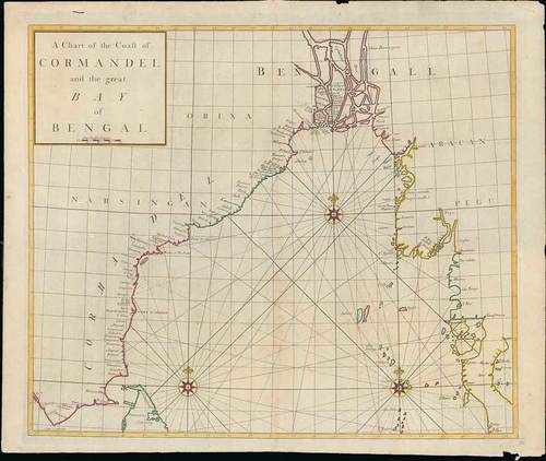
1728 A chart of the Coast of Coromandel and the great Bay of Bengal, by Edmund Halley, Nathaniel Cutler and John Senex; 25 x 21 inches, outline coloured.
A scarce sea chart of the east coast of India, north Ceylon and the coastline towards the east, from the "Atlas Maritimus & Commercialis ...," published in London in 1728.
This very rare work was a collaborative effort of a number of the leading cartographic and scientific names of the period, including Sir Edmund Halley, John Senex, Nathaniel Cutler, Steven Parker and Daniel Defoe, whose names are frequently associated with this work. The sea atlas was developed by Senex and Harris to compete with Mount & Page’s wildly popular English Pilot sea series. It was published under the name "Atlas Maritimus et commercialis", or A general view of the world. While the collaboration was impressive, the atlas never achieved the same commercial success. As such, the maps are quite scarce on the market.
Central fold, light overall ageing and soiling and a few paper imperfections at the edges. Photo
Estimate
SG$500 to SG$600


