Auction: 15040 - Antique Maps sale during the International Exhibition
Lot: 127
Maps
India
Bay of Bengal
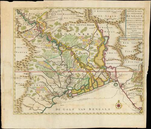
1724 Nieuwe Kaart van 't Koninkryk Bengale, by Francois Valentyn; 24 x 21 inches, hand-coloured.
Published by Jan van Braam and Gerard onder de Linden, Dordrecht, this folio sized copper engraving of the sultanate of Bengal with the delta of the Ganges. Dutch East India Company map depicting the Dutch forts and agricultural areas, produced by Francois Valentijn. Valentijn was able to access the secret Dutch East Iindia Company archives for his work.
Folding creases, some staining and ageing. Photo
Estimate
SG$600 to SG$800


