Auction: 15040 - Antique Maps sale during the International Exhibition
Lot: 129
Maps
India
Bay of Bengal
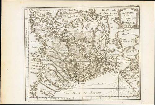
1750 Nouvelle carte du Royaume de Bengale, by Jacques Nicolas Bellin; 19 x 12¾ inches, uncoloured
A detailed regional map of the Gulf of Bengal and the lower Ganges River. Decorative title cartouche. Relief shown pictorially, depth shown by soundings and shows vegetation, settlements, etc. From "Le Petit Atlas Maritime Recueil De Cartes et Plans Des Quatre Parties Du Monde. en Cinq", volume III Asia and Africa.
Dark impression. Printed on heavy paper; small defects at right and with some light peripheral toning. Photo
Estimate
SG$200 to SG$250


