Auction: 15040 - Antique Maps sale during the International Exhibition
Lot: 126
Maps
India
Bay of Bengal
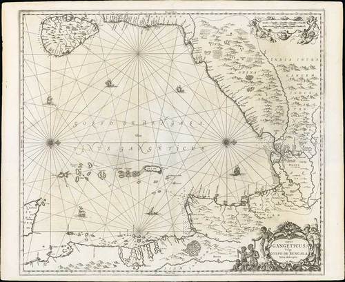
1659 Sinus Gangeticus, vulgo Golfo de Bengala nova descriptio, by Jan Jannson; 24 x 19¼ inches, uncoloured.
This exceptional sea chart of the Bay of Bengal includes the island of Ceylon, eastern India, Bangladesh, Burma, and a small portion of Sumatra. This later edition of Jansson’s map of the Bay of Bengal is one of the earliest obtainable sea charts to focus on the area. The chart is displayed with a westward orientation and the sea is strapped with rhumb lines and adorned by numerous sailing ships and two compass roses. Even more impressive is the amount of detail included inland from the coasts. Tilled rice fields, rivers, mountains, forests, villages, and cities fill the map with information and beauty. A formation of putti surrounds the scales of distance at the top of the map. In the lower right corner, an elaborate title cartouche is flanked by natives of differing origin.
Stout paper with Latin text on verso. Reinforced central fold with some minor wrinkling. Photo
Estimate
SG$800 to SG$900


