Auction: 15040 - Antique Maps sale during the International Exhibition
Lot: 116
Maps
India
Mogolis
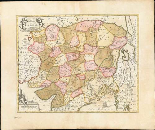
1720 (c.) Magni Mogolis Imperium, de Novo Correctum et Divisum, by F. de Witt, Amsterdam, J. Covens & C. Mortier; 25½ x 21½ inches, old coloured
An attractive map of the region bounded by Northern India, Pakistan, Afghanistan and Bangladesh and extending inland up the Ganges and Indus Rivers to Tartary and the Himalayas, including Katmandu, Kabul and other legendary cities along the great trading route.
Extends south to include a large portion of India, including Narsinga, Orixa Decan, etc. Elephants shown roaming the Ganges and Camels east of Kabul. Decorative cartouches featuring putti, and sailing ships. The map was originally issued by De Wit, circa 1690. The Covens & Mortier edition of this map is quite rare.
Some minor soiling but still a fine example of this map. Photo
Estimate
SG$600 to SG$800


