Auction: 15040 - Antique Maps sale during the International Exhibition
Lot: 115
Maps
India
Mogolis
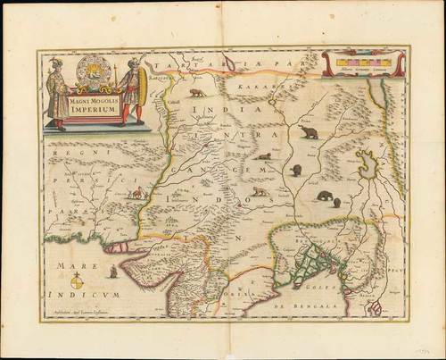
1639 Magni Mogolis Imperium, by Jan Jansson; 23½ x 18¾ inches, old coloured.
A fine example of Jan Jansson’s edition of William Baffin’s map of Mughal Empire, the first broadly accurate map of Northern India.
This revolutionary map embraces the entire Mughal Empire, and extends from Afghanistan and Kashmir in the north, down south to the middle of the Deccan, and from the mouths of the Indus in the east, to Burma in the west. While far from scientific, and featuring some obvious inaccuracies (notably, areas in the upper part of the map are placed way too far to the north), it is the first map of Northern India to evince a rough level of planimetric accuracy. The original map on which the present edition is predicated was devised by the great English adventurer William Baffin, after information supplied to him by Sir Thomas Roe, England’s first ambassador to the Mughal Empire.
The title cartouche, in the upper left, features the modified seal of the Emperor Jahangir (reigned 1605-27), featuring roundels bearing his name and those of his eight dynastic predecessors going back to the great Turco-Mongol ruler, Timur (Tamerlane the Great). In the middle is the symbol of the Mughal Empire, featuring a lion at repose in front of a rising sun. There are depictions of animals with a camel. elephants and large cats. The reverse with text in German.
Large paper split in the upper margin and a few minor age marks. A good example of this early map. Photo
Estimate
SG$600 to SG$800


