
Auction: 26776 - America 250th Anniversary Sale Ft. Coins, Medals, Banknotes, Objets de Vertu & Ephemera
Lot: 56
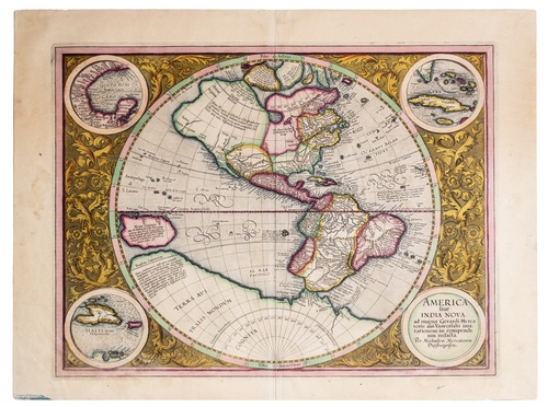
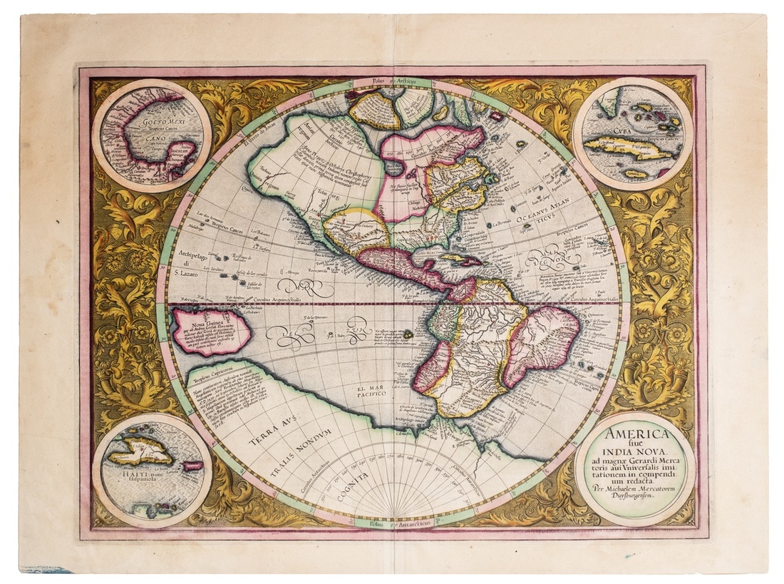
(x) USA, siue, India Nova: ad magnae Gerardi Mercatoris auri Vniversalis imitationem in compendium redacta, by Gerard Mercator (1512-1594) and Michael Mercator (1567-1600), later edition by Jodocus Hondius, Amsterdam, c.1613-1630, published in 'Atlas Sive Cosmographicae Meditationes De Fabrica Mundi Et Fabricati Figura', double-page hand-coloured engraved map, circular map of the western hemisphere, including North and South America, Atlantic Ocean, Pacific Ocean, New Guinea and Australian territories. Four roundels highlighting Gulf of Mexico, Cuba, Haiti and title of map, with decorative floral background, rev. latin text from pages 39 and 40 of the atlas, folio page 43cm x 56cm, map 37cm x 47cm, vertical central crease and repair to reverse seam, minor foxing to borders and reverse, yet skilfully hand-coloured and with near full original colour, some loss to roundel borders, good fine
Produced by Michael Mercator, this map is one of the most well-known depictions of the early Americas. After the death of the great cartographer Gerard Mercator in 1594 it was left to his son and grandson to publish the last three parts of the Atlantis Pars Altera. The task of the American map was given to his grandson Michael, and it is the only map that he is known to have produced.
Intricately engraved and framed by a decorative floral border, it features four corner roundels identifying areas of Spanish control in the region. Like most maps of its era, it reflects the prevailing geographical theories and misconceptions of the time. There is a large inland lake in Canada and the St Lawrence River extends nearly halfway across the continent, but no Great Lakes are included. There is a bulge in the west coast of South America and the large southern continent extends above the Tropic of Capricorn. Above North America are two of the four islands of the North Pole, with the great mythical rivers flowing from the pole. The seas are full of mythical islands, including St. Brendain, Frislant and Sept citez.
The atlas was first published in 1595 from Duisburg. In 1604 Mercator's original plates were purchased by Jodocus Hondicus. Under the care of Hondicus he continued to publish the atlas in a number of editions extending into the 17th century, steadily expanding it from 107 maps in the first edition to 150 by the 1613 edition.
Subject to 5% tax on Hammer Price in addition to 20% VAT on Buyer’s Premium.
Estimate
$500 to $600
Starting price
$400

Watch, listen and bid as if you were in the room. Now available for auctions worldwide.
Click here to bid live
An exclusive and confidential service for the discerning collector or vendor.
View the Gallery
Download every Spink catalogue on your iPad, iPod or iPhone using free Spink app.
Download From iTunes© 2026 Spink & Son. All rights reserved.