Auction: 15040 - Antique Maps sale during the International Exhibition
Lot: 156
Maps
Middle East
Persia
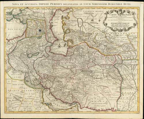
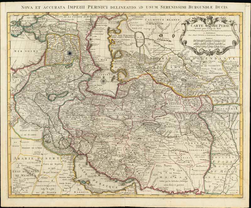
1742 Carte de Perse, by Covens & Mortier; 25 x 21 inches, original outline colour. Also titled Nova et accurata imperii Persici delineatio ad usum Serenissimi Burgundiae Ducis.
Covens and Mortier reissued a chart originally made by Guillaume de l'Isle showing the Persian Empire. The depicted area stretching from Crimea to Kashmir and from the Caspian Sea to the Persian Gulf. The detailed representation of towns, villages, rivers and further regional conditions, in particular the mapping of the roads, leads to the presumption that this chart was created for military purposes. French inscriptions, spread all over the chart, e.g. that the Baloch, inhabitants of south-east Persia, were very militant people. The famous flats of Bahrain, where legendary pearls grow, is clearly marked. The title cartouche is in Rococo-style and is decorated with twisting and floral elements and a royal coat of arms.
Usual reinforced centre fold with repaired split at foot, and other light folds, good to fine. Photo
Estimate
SG$1,000 to SG$1,200

Watch, listen and bid as if you were in the room. Now available for auctions worldwide.
Click here to bid live
An exclusive and confidential service for the discerning collector or vendor.
View the Gallery
Download every Spink catalogue on your iPad, iPod or iPhone using free Spink app.
Download From iTunes© 2026 Spink & Son. All rights reserved.