Auction: 15040 - Antique Maps sale during the International Exhibition
Lot: 148
Maps
Middle East
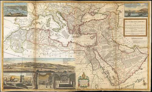
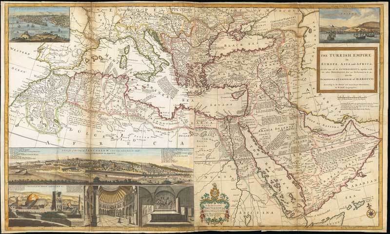
1720 (c.) The Turkish empire in Europe, Asia and Africa divided into all its Governments ..., by Hermann Moll; 41 x 24½ inches, original outline colour with hand-coloured illustrations.
Printed in London by Hermann Moll, John Bowles, Thomas Bowles, Philip Overton & John King. This map of Europe and the Middle East is printed on two sheets and conjoined. Moll's large-format map of the Turkish Empire, also covering the whole Mediterranean, first published 1714. There are inset prospects of Constantinople, Smirna and Jerusalem, and three views of the Holy Sepulcre. Title cartouche and dedication to Thomas Vernon (Commissioner of Trade and Plantations).
Repaired down both vertical folds and a couple of repaired tears. There are some stains and soiling, particularly around the folds. Nevertheless a good example of this rare map. Photo
Estimate
SG$5,000 to SG$6,000

Watch, listen and bid as if you were in the room. Now available for auctions worldwide.
Click here to bid live
An exclusive and confidential service for the discerning collector or vendor.
View the Gallery
Download every Spink catalogue on your iPad, iPod or iPhone using free Spink app.
Download From iTunes© 2026 Spink & Son. All rights reserved.