Auction: 15040 - Antique Maps sale during the International Exhibition
Lot: 135
Maps
India
Indoustan
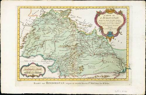
1754 Carte de L'Indoustan ..., by Jacques Nicolas Bellin; 17 x 11 inches, hand-coloured.
With two decorative cartouches, reinforced central fold, fine
An attractive map of northern India that appeared in Antoine Francois Prevost d'Exiles' (or Abbe Prevost's) multi-volume "Histoire Generale Des Voyages": ultimately 17 quarto volumes recounting major voyages of discovery and descriptions of far flung parts and including around 240 maps, plans and charts of those areas. These maps, plans and charts were mostly produced by Jacques Nicolas Bellin, the influential French hydrographer. Bellin's work spans from around 1740 to the 1770s; interestingly he signed his plates in a variety of styles - J. Bellin, N. Bellin, N.B., M.B. (Monsieur Bellin) and S.B. (Seigneur Bellin).
Estimate
SG$100 to SG$120


