Auction: 15040 - Antique Maps sale during the International Exhibition
Lot: 109
Maps
India
General
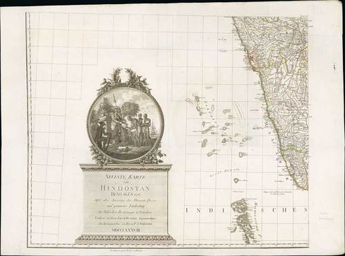
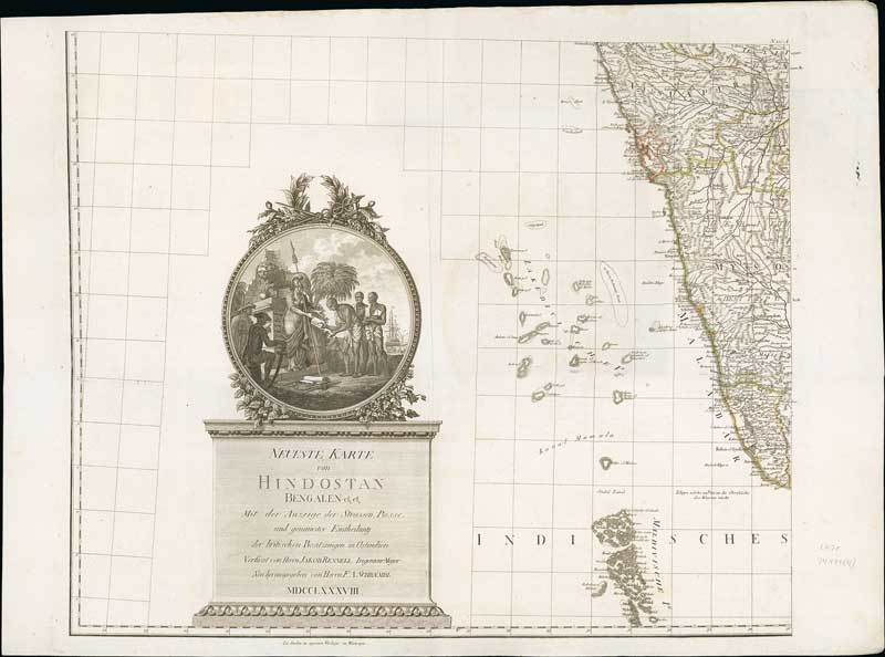
1788 Neueste Karte von Hindostan, Bengalen etc, etc. Mit der Anzeige der Strassen Paesse, und genauester Eintheilung der Britischen Besitzungen in Ostindien; by F.A. Schraembl and J. Rennell. Four maps making a complete wall chart, each 34½ x 25¼ inches with original outline colours.
Wall map of the Indian sub-continent after James Rennell, with large title cartouche of Britannia, native figures, a soldier and a merchant. Published by F. A. Schraembl in Vienna after Jacob Rennel.
Fine with occasional light surface dirt. Photo
Estimate
SG$500 to SG$600

Watch, listen and bid as if you were in the room. Now available for auctions worldwide.
Click here to bid live
An exclusive and confidential service for the discerning collector or vendor.
View the Gallery
Download every Spink catalogue on your iPad, iPod or iPhone using free Spink app.
Download From iTunes© 2026 Spink & Son. All rights reserved.