Auction: 15040 - Antique Maps sale during the International Exhibition
Lot: 108
Maps
India
General
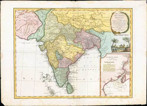
1786, Presqu'Isle des Indes Orientales, Comprenant l'Indostan ou Empire du Mogol, Differens Royaumes ou Etats, Les Vastes Possessions des Anglais, et les autres Etablissemens Europeens, avec les Grandes Routes, by Robert de Vaugondy; 30 x 22 inches, hand-coloured.
This map covers the Indian subcontinent from independent Tartary south to include Ceylon and the Maldives and from Persia east as far as Aracan in the east. It offers extraordinary detail throughout, with numerous notations on matters geographical, historical, and cultural. Shows roads, cities, mountain ranges, lakes and rivers with territories depicted by outline color. Identifies Delhi (or Jehan Abad), Agra (or Ekbar Abad), Bombay, Goa, Calcutta, Pondicherry, and countless other major and minor cities. An inset in the lower right quadrant focuses on the mouths and the course of the River Ganga or Ganges from Hooghly, south part Calcutta into the Bay of Bengal. The cartouche in a floral frame with illustration of an elephant, trees and church below.
Some staining and scuffing, mainly confined to the margins. Photo
Estimate
SG$600 to SG$800


