Auction: 15040 - Antique Maps sale during the International Exhibition
Lot: 83
Maps
Asia
Korea
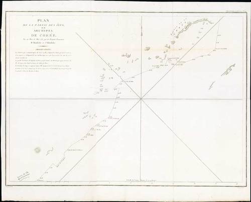
1787 Plan de la partie des iles, ou archipel de Coree, vue au mois de Mai 1787 par les Fregates Francaises la Boussole et l'Astrolabe, by J.F.G. la Perouse; 28 x 23 inches, uncoloured.
La Pérouse's important chart depicting the discoveries he made in 1787 in the seas of China and Tartary. The travels are charted from the Philippines to the south of Taiwan and the Pescadores. The ship swings around the eastern side of the island and goes north to a passage between Korea and Japan. The Ryukyus are disproportionate.
Engraved by Bouclet and published in the Atlas volume that accompanied the important account of 1785 scientific expedition under the command of Comte de Jean Francois Galoup la Perouse set out with two ships, "Boussole" and "Astrolabe," to circumnavigate the world. The voyage turned out to be destined to an unfortunate fate. La Perouse stopped in Botany Bay, Australia, where he left letters and his journals. The ships left for France and were never heard from again. In 1826 the remains of the two vessels were found on an island north of the New Hebrides.
With the usual folds, fine. Photo
Estimate
SG$1,000 to SG$1,200


