Auction: 15040 - Antique Maps sale during the International Exhibition
Lot: 80
Maps
Asia
Japan
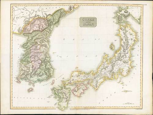
1815 Corea and Japan, from Thomson's New General Atlas, sheet "No.38"; 28 x 20¾ inches, original colouring.
A fine steel plate engraving for the new atlas printed by George Ramsay and Company, for John Thomson and Company, Edinburgh; first published 1817. A beautifully crafted map of Japan and Korea from an interesting period in the history of the country. The map shows population centers, waterways and topography using the hachuring method to illustrate elevations. Interior information is well represented, with precise engraving. The delicate colouring highlights the information given, making the map both easier to read and pleasing to look at. Altogether, a fine example of early 19th-century British cartography.
Usual reinforced central fold; a few imperfections at the margin edges and a couple of light vertical bends. Photo
Estimate
SG$600 to SG$800


