Auction: 15040 - Antique Maps sale during the International Exhibition
Lot: 66
Maps
China
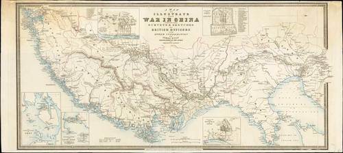
1842 A map to illustrate the War in China compiled from surveys & sketches of British Officers and other information by James Wyld; 30 x 13½ inches, outline colour.
Map of the Pearl River estuary to Yellow Sea and Peking. Detailed annotations describe local topography, flora, fauna, internal roads, waterways. Insets depict attack on Canton 1841, Peking, Amoy, the attack by British forces on the fortifications in Canton River 1841 (with the positions and names of the war ships), and finally Tin-Hai in Chusan. Record of the region records events the led to establishment of Hong Kong as a colonial settlement.
Some ageing and staining in the upper corners. A rare and important map. Photo
Estimate
SG$1,500 to SG$1,800


