Auction: 15040 - Antique Maps sale during the International Exhibition
Lot: 63
Maps
China
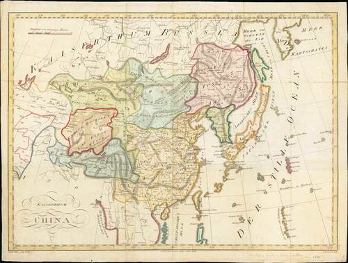
1813 Kaiserthum China by an anonymous map maker (initials only), Vienna, from the Austrian Atlas "Atlas der neuen Geographie", 23 x 17½ inches, with original colours.
An unusual copper-engraved map of the area from the Aral lake to the Sea of Okhotsk showing parts of todays China, Russia, Mongolia, India, Tibet, Korea and Japan. Lists the cities of Lhasa, Irkutsk, Kathmandu, Ulan Bator (Urga), and many more.
Decorated with a large title and a distance scale. Nice hand colouring indicates the different regions. This map is numbered "45B" in the lower corner and it appears that map "45A" was just the left half.
Good impression, mostly clean with only some light soiling, usual central reinforcement and other folds with a couple of reinforcements. A very scarce map. Photo
Estimate
SG$600 to SG$800


