Auction: 15040 - Antique Maps sale during the International Exhibition
Lot: 56
Maps
China
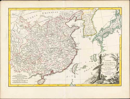
1780 (c.) L'Empire de la Chine d'après l'Atlas Chinois avec les Isles du Japon, by Rigobert Bonne; 20 x 15½ inches, original outline colour.
Detailed map of China, Korea and the Islands of Japan, showing the Provinces, towns, mountains, rivers, lakes, islands, published in Paris by Jean Lattre. Drawn by R. Bonne in 1783 for issue as plate no. 27 in Jean Lattre's 1783 issue of the "Atlas Moderne". The map is drawn from D'Anville's atlas of China and includes a ldecorative cartouche in the lower right quadrant depicts a Chinaman smoking opium and admiring a bird perched in his index finger while relaxing under an umbrella amongst bucolic surroundings.
On stout laid watermarked paper, usual central reinforcement; good to fine. Photo
Estimate
SG$1,000 to SG$1,200


