Auction: 15040 - Antique Maps sale during the International Exhibition
Lot: 39
Maps
China
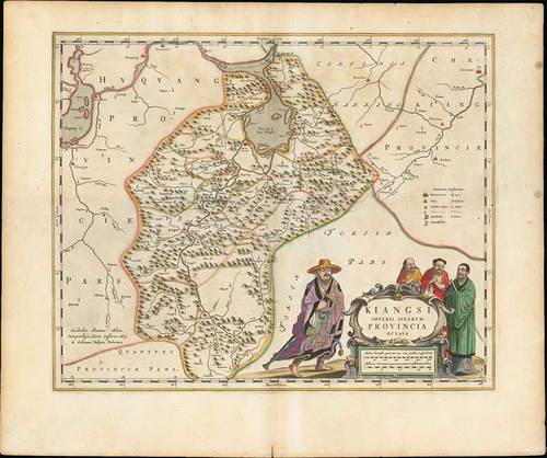
1655 Kiangsi Imperii Sinarum Provincia Octava, by Johannes Blaeu; 19½ x 16 inches with nearly three inch border, old coloured.
Copper engraving on stout wove paper. From "Novus Atlas Sinensis a Martino Martinio Soc. Iesu Descriptus ...", Amsterdam. The map with the mountainous areas of Kiangsi with Nanchang on the edge of Lake Poyang. The elaborate cartouche features four Chinese gentlemen in outdoor clothing.
Usual reinforcement down central fold; some light soiling and split at foot which is just confined to the margin. Photo
Estimate
SG$1,000 to SG$1,200


