Auction: 15040 - Antique Maps sale during the International Exhibition
Lot: 38
Maps
China
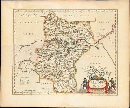
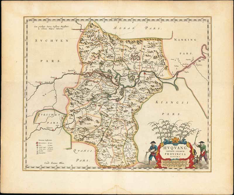
1655 Huquang Imperii Sinarum Provincia Septima, by Johannes Blaeu; 19½ x 16 inches with nearly three inch border, old coloured.
Copper engraving on stout wove paper. From "Novus Atlas Sinensis a Martino Martinio Soc. Iesu Descriptus ...", Amsterdam. This map of the Hubei province is centered on the Yangtze River, Kiang Flu Pars. A legend at bottom left illustrates towns of various sizes, forts, and the locations of silver mines. The city of Vuchang (Wuhan) is located along the river. A strapwork title cartouche incorporates the scale of miles and is flanked by two rice farmers.
Usual reinforcement down the central fold; small water stain and paper split at foot. Photo
Estimate
SG$1,000 to SG$1,200

Watch, listen and bid as if you were in the room. Now available for auctions worldwide.
Click here to bid live
An exclusive and confidential service for the discerning collector or vendor.
View the Gallery
Download every Spink catalogue on your iPad, iPod or iPhone using free Spink app.
Download From iTunes© 2026 Spink & Son. All rights reserved.