Auction: 15040 - Antique Maps sale during the International Exhibition
Lot: 4
Maps
Asia
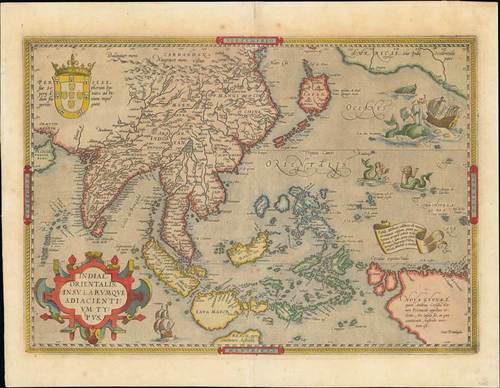
1571 Indiae Orientalis, Insularumque Adiacientium Typus, by T. Ortelius; 21¼ x 16½ inches, hand-coloured.
Fine example of Ortelius' map of S.E. Asia, Japan, and the Philippines, etc. The map includes beach and other information drawn from Marco Polo. The map also includes a portion of the West Coast of North America, including several mythical names in California. Based upon Mercator's world map of 1569. The difficulty of mapping this archipelago was such, that for centuries to come maps of this area remain faulty. Sumatra and Java are heavily oversized, and the Philippines are incomplete and without the northern island of Luzon.
The mermaids, who are beautifying themselves rather than heeding the whales' attack on nearby ships, are based on those occurring on Diego Gutierrez map of America. From a French edition of the Atlas "Theatrum Orbis Terrarum". The privilegium is found in the lower right corner and with French text on verso.
Usual reinforced centre fold, light overall ageing, nevertheless a fine example of this scarce map. Photo
Estimate
SG$7,000 to SG$8,000


