Auction: 15040 - Antique Maps sale during the International Exhibition
Lot: 3
Maps
World Maps
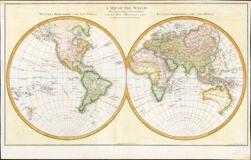
1779 A Map the World with the Latest Discoveries by John Blair; 30½ x 18 inches, hand-coloured.
This large double hemisphere map was issued as an addendum to Blair's famous tables of chronology. It reflects the latest exploration discoveries, specially those made by James Cook during his three expeditions on the Endeavour.
The first voyage in 1768-1771 led to the good delineation of the New Zealand isles and of the Australian west coast, and the correct position of Otaheite ( Tahiti).
The second voyage in 1772-1775 dispelled the existence of a large southern continent, Cook crossing the polar circle could not locate any landmass.
The last voyage dispelled the myth of the straight of Anian (also linked to the fabled northwest passage over and above Canada), and discovered the Sandwich Islands (Hawaii), where he was killed by natives. Interesting N.W. Coast of America is still based largely on the Russian discoveries and includes Behring's coast.
Central fold and two other vertical folds. There is some splitting in the margins. Good to fine. Photo
Estimate
SG$2,500 to SG$3,000


