Auction: CSS65 - The Philatelic Collectors' Series Sale
Lot: 6166
Miscellaneous
Others
Map
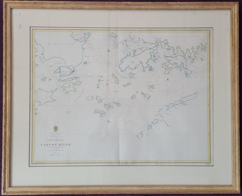
1840 "China South Coast, Entrance to the Chou-Kiang or Canton River from the Outer Islands to Lintin", published according to Act of Parliament at the Hydrographic Office of the Admiralty, March 10th 1840. Cartographer: ROSS, Captain Daniel. Framed, edges coloured. Image size: 25" x 19", frame size: 32" x 26". Clean and Fresh; framed by Galerie du Monde May 2001.
A rare and remarkable nautical chart of the utmost significance. This 1840 maritime map of Hong Kong and vicinity is attributed to Captain Danirl Ross, Bombay Marine. During the first Opium War (1839-1842), this was the finest and most detailed chart of Hong Kong available.
"This map is derived from Daniel Ross's 1870-1816 survey of the China Coast on behalf of the British East India Company. Ross's survey work and his manuscript chart (possibly National Library of Australia Map RM 1590), was largely forgotten until the first Opium War, when his work was resurrected to serve as the basis for this updated March of 1840 chart. The updates over Ross's 1815 survey, which include additional soundings and other details, were mostly based the surveys of I.a. Douglas, in 1839, at the outset of the first Opium war.
詳看英文描述
Sold for
HK$22,000
Starting price
HK$22000


