Auction: 352 - Autographs and Documents e-Auction
Lot: 170
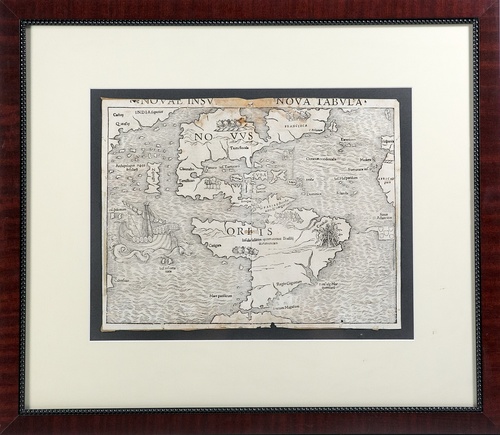
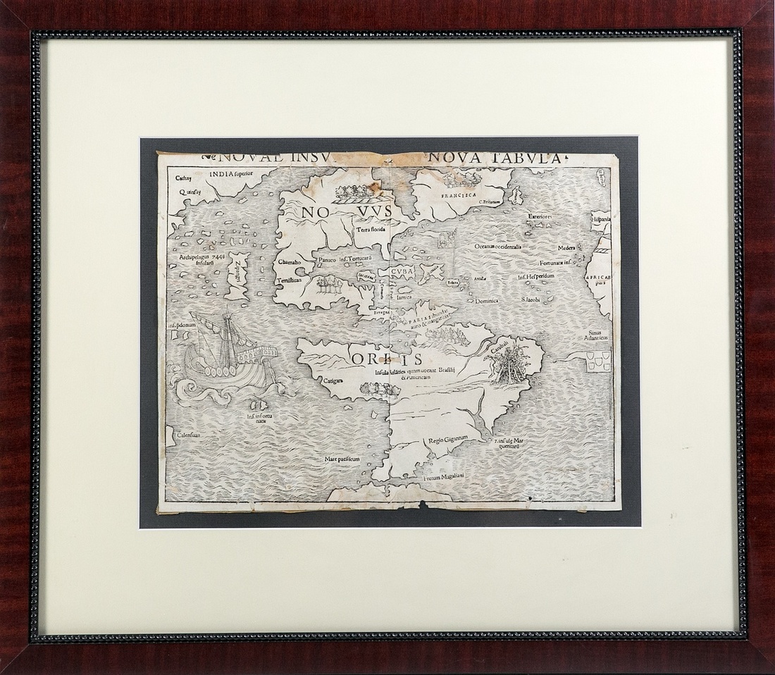
Novae Insvlae, XVII Nova Tabvla. By Sebastian Munster (1488-1552). Published in Munster's "Cosmographiae Universalis Lib. VI", Basel, 1540. First edition, first state with Temistitan in North America and Insula Atlatica in South America and NOVVS ORBIS in North and South America. 13 3/8 x 10" (plus margins which have been trimmed). A fine woodcut map of the Americas stretching from Greenland, down the coast of Newfoundland to Florida and the Caribbean - with "CVBA" distinctly labeled - as far south as the Strait of Magellan.
One of the most influential cartographers of the 16th Century, Munster depicts North America on the eve of Spanish exploration of the western interior; while the outline of South America is based on Magellan's voyage. Cannibals in South America are depicted, the Yucatan is misconstrued as an island, and 'terra florida' is named. The Portuguese flag flies next to South America. The Spanish flies over the Caribbean. The corners of Asia, Europe and Africa are near the borders, while a large ship sails at left. A seminal work, this is the earliest map to show all North and South America in true continental form and the first to name the Pacific Ocean -- "Mare pacificum".
A Rare and important map. Some thinning spots, "..lae, XVII" of title faint (but clearly "XVII"), tiny hole near bottom margin and a few edge nips. Good. Attractively framed, 23 x 20".
Estimate
Starting price
$2000

Watch, listen and bid as if you were in the room. Now available for auctions worldwide.
Click here to bid live
An exclusive and confidential service for the discerning collector or vendor.
View the Gallery
Download every Spink catalogue on your iPad, iPod or iPhone using free Spink app.
Download From iTunes© 2026 Spink & Son. All rights reserved.