Auction: 15040 - Antique Maps sale during the International Exhibition
Lot: 201
Maps
Pacific Ocean
Oceania
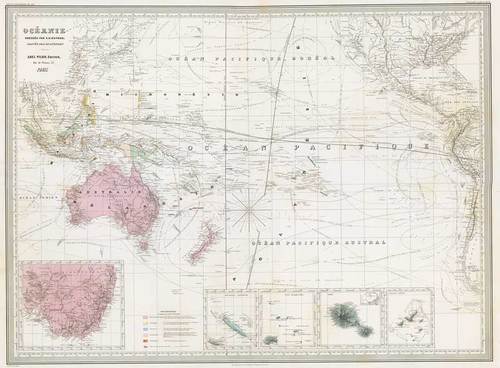
1860-69 Océanie dressée par A.H. Dufour ; gravée par Ch. Dyonnet. Abel Pilon, Editeur ... Paris, by Auguste-Henri Dufour; 31¾ x 22½ inches, original colour.
In French. Map of Oceania showing ocean currents and European possessions. A superbly detailed nautical chart of the Pacific Ocean showing all of Australia, Indonesia, and Japan as well as most of North America and the west coast of South. Includes five insets: southeastern Australia, New Caledonia, the Marquesas, Tahiti, and the Gambier Archipelago (French Polynesia).
Relief shown by hachures. In lower left margin: La Lettre par Guyen. In lower margin: Imp. Geny-Gros, r, de la Montagne S'te. Genevieve, 34, Paris. In upper left margin: Atlas universel Pl. 40. In upper right margin: Geographie moderne Pl. 31.
Central fold, crease in left side, small splits at top and some bends and a couple of minor age marks. Photo
Estimate
SG$1,000 to SG$1,200


