Auction: 15040 - Antique Maps sale during the International Exhibition
Lot: 199
Maps
Pacific Ocean
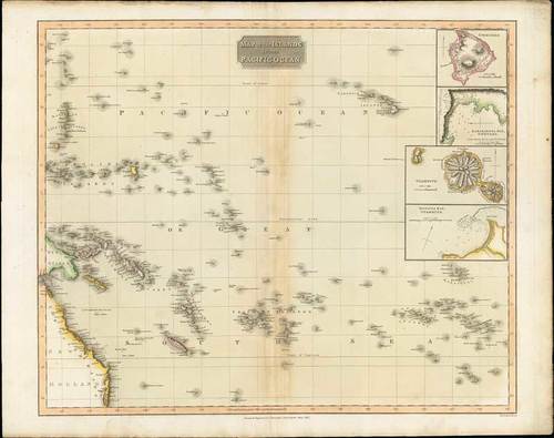
1817 Map of the Islands in the Pacific Ocean, by John Thomson; 27 x 21½ inches, original outline colour.
Interesting map of the region bounded by Australia, the Marinanas and the South Pacific from Thomson's "New General Atlas". Focuses on the area between the Tropic of Cancer and the Tropic of Capricorn, and including some area north and south of the tropics. Shows the Hawaiian Islands (Sandwich Islands), Society Islands, Solomon Islands, Caroline Islands, New Hebrides, Friendly Islands, the eastern part of New Guinea, and the coast of New South Wales, Australia. Four insets of Owhynee (Big Island of Hawai'i), Karakakooa Bay, Otaheite (Tahiti), and Matavia Bay. Excellent detail along the coast of Australia and New Guinea as well. A nice example of this map printed on heavy paper with wide margins. One of the few early 19th century large format commercial atlas maps to treat this area.
Some creasing around the regular central reinforcement, some light overall soiling. Photo
Estimate
SG$700 to SG$800


