Auction: 15040 - Antique Maps sale during the International Exhibition
Lot: 197
Maps
South America
Brazil
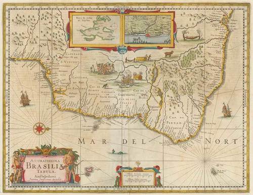
1644 (from) Accuratissima Brasiliae Tabula, by Joannes Janssonius; 22¾ x 20 inches, old colour.
Oriented with west at the top. Brazil is divided into Capitanias, with excellent coastal detail and a more speculative detail in the interior parts of the map. Includes inset vignettes of indigenous scenes and animals. Inset maps of the "Baya de Todos os Sanctos" and "Villa d'Olinda de Pernambuco". German text on verso "Die Landtchafft Brasilien"
Usual central reinforcement; small tear in left margin, good to fine. Photo
Estimate
SG$800 to SG$1,000


