Auction: 15040 - Antique Maps sale during the International Exhibition
Lot: 192
Maps
America
North America
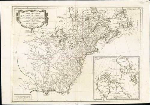
1784 Carte Générale du Canada, de la Louisiane, de la Floride, de la Caroline..., by P. Santini and M. Remondini; 29½ x 20¼ inches, uncoloured.
On stout paper, map of the eastern part of the United States and Canada. With inset map of Hudson and Baffin bays in the lower right corner. This is the Venetian edition of d'Anville's map, from "Atlas Universel" printed in 1784. Noteworthy topographical detail is shown, with particular focus on the Great Lakes. Lake Superior is attached to a convoluted river system reaching across the continent reminiscent of the Riviere Longue of Baron Lahontan's memoirs. On the Gulf Coast the region of Tecas (Texas) is named with a nearby note about the Atac-apa tribe of Indians, who are noted as Antrophages (Cannibals) and Indiens errans. The map was prepared by the Venetian cartographer and publisher François Santini and first published in Santini's "Atlas Universel dresse sur les meuilleures cartes modernes 1776." Santini collaborated with Janvier and gives credit to him on most of his maps. The atlas is effectively an Italian copy of the Robert de Vaugondy "Atlas Universel". In 1784 Santini sold the plates to M. Remondini, whose name appears on this particular example - indicating that this is the second state of the map.
Usual central reinforcement, there is a weakness or split in the lower margins. Afine example of this popular map. Photo
Estimate
SG$3,500 to SG$4,000


