Auction: 15040 - Antique Maps sale during the International Exhibition
Lot: 185
Maps
Europe
Great Britain
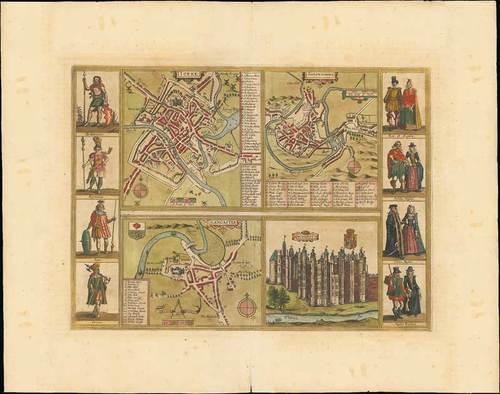
1617 Yorke Shrowesbury Lancaster Richmont, from ivitates Orbis Terrarum, by Braun and Hogenberg; 23¼ x 18¼ inches, original colour.
Four views bring city plans of York, Shrewsbury and Lancashire and a view of the castle of Richmond. On each side of the four views are four figures in historical dress: Briton / Roman / Saxon / Dane; king and queen / English nobles / English burghers / English peasants. The four views are engraved after views published by Speed in his atlas "The theatre of the empire of Great Britaine, 1611". Latin text on verso with details of York.
"Civitates Orbis Terrarum" could be called the first city atlas; published in six parts between 1572 and 1617 it encompassed well over 500 plans and views of towns and cities from Europe (predominantly), North Africa, the Near East and the Americas. The town plans of York, Shrewsbury and Lancaster are all based on those of Speed’s county maps.
Reinforced central fold with some splitting in the upper and lower margins; small damage in left margins and light overall toning. Photo
Estimate
SG$500 to SG$600
Sale 15040 Notices
Estimate restated to S$700-900


