Auction: 15040 - Antique Maps sale during the International Exhibition
Lot: 181
Maps
Europe
Baltic Coast
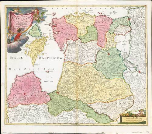
1720 (c.) Ducatuum Livoniae et Curlandiae cum vicinis Insulis Nova Exhibitio Geographica, by Johann Baptiste Homann; 24 x 21¼ inches, old colour.
The northern Baltic coast in this early version. Estonia, Latvia and the fortified settlements of Derpt and Goldingen. The islands of Hiiumaa and Saaremaa are in the Gulf of Riga. The title cartouche at the top left shows a group of armed putti fighting. A grid borders the map for quick reference and the mileage scale is at the bottom right hand side. The interior is very detailed with many lakes, settlements, mountain ranges and swampy areas.
Usual central reinforcement, trivial ink stains in the lower margin. Photo
Estimate
SG$1,000 to SG$1,200


