Auction: 15040 - Antique Maps sale during the International Exhibition
Lot: 174
Maps
Europe
Russia - Caspian Sea
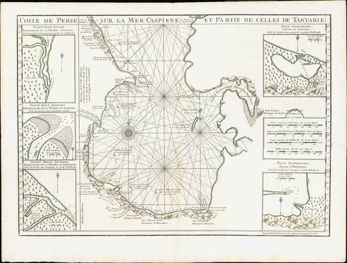
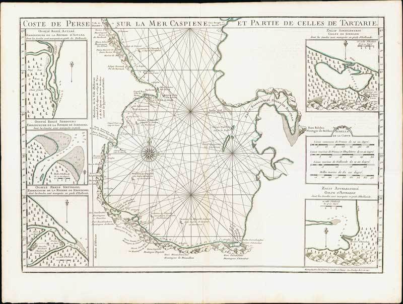
1721 Carte Marine de la Mer Caspiene, by de l'Isle and van Verden; two maps, each 27 x 20½ inches with simple outline colour.
A seminal production, this is Guillaume de l'Isle's 1721 map of the Caspian Sea according to the surveys of Van Verden and S. I Soimonov. It is the first printed map of the Caspian Sea based upon actual survey work. Although other cartographers also copied the work of Van Verden and Soimonov, de l'Isle was the first, and his mapping is the finest and truest to the original manuscript. The map proper is surrounded by eight inset maps detail various gulfs, bays, ports, and rivers. The upper sheet has two large cartouches, the left bearing the title and dedication to Van Verden and the right a description of the map. The right hand cartouche also features two dragons.
Each sheet with the usual reinforced centre fold; fresh and fine. Photo
In 1721 Peter presented the Paris Academie Royale des Sciences with a copy of S. I. Soimonov and Carl Vanverden's map of the Caspian region. Without further delay, De l'Isle redrew the map (with great care), translated the inscriptions into French and printed it on separate sheets in reduced size in the Travaux of the Academy. He also included the map in his Atlas. In this way, the exact outline of the Caspian Sea, drawn on the Russian map of 1720, first appeared in a map prepared in western Europe
Estimate
SG$2,000 to SG$2,500

Watch, listen and bid as if you were in the room. Now available for auctions worldwide.
Click here to bid live
An exclusive and confidential service for the discerning collector or vendor.
View the Gallery
Download every Spink catalogue on your iPad, iPod or iPhone using free Spink app.
Download From iTunes© 2026 Spink & Son. All rights reserved.