Auction: 15040 - Antique Maps sale during the International Exhibition
Lot: 160
Maps
Middle East
Palestine
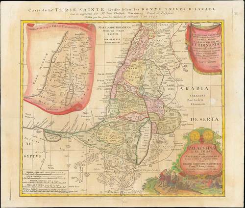
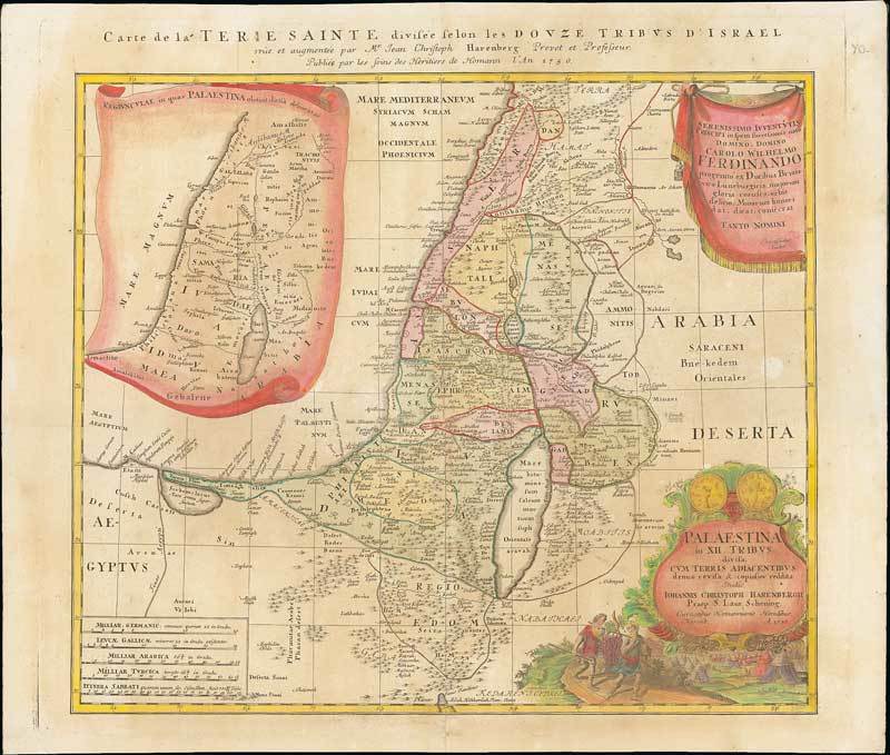
1750 Carte de la Terre Sainte Divisee selon les Douze Tribus d'Israel, by Johann Christoph Harenberg; 24 x 20½ inches, the map with original colours but the the cartouches and side map with later hand-colour.
Published in Nuremberg on stout paper, this map covers the coastline from Biblus nunc Gibele to the Sirbonis lacus. A map showing the region in Roman times is inset in a decorative scroll at left. The title cartouche is topped with two sides of a shekel coin. Below the cartouche is a scene of the encampment of the Jews with two spies of Moses bearing the fruit from the Promised Land.
There are some later reinforcements to the central fold and there is some overall staining and soiling. Photo
Estimate
SG$700 to SG$900

Watch, listen and bid as if you were in the room. Now available for auctions worldwide.
Click here to bid live
An exclusive and confidential service for the discerning collector or vendor.
View the Gallery
Download every Spink catalogue on your iPad, iPod or iPhone using free Spink app.
Download From iTunes© 2026 Spink & Son. All rights reserved.