Auction: 15040 - Antique Maps sale during the International Exhibition
Lot: 75
Maps
Asia
Japan
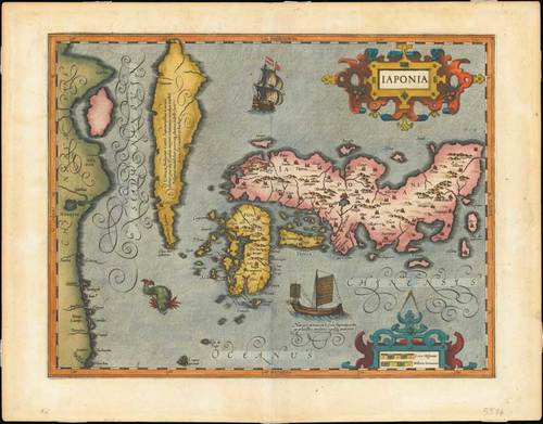
1606 Iaponia, by G. Mercator and J. Hondius; 21¼ x 16½ inches, old coloured. First issued as one of the new maps in the expended "Mercator Hondius Atlas" of 1606. With text on verso.
One of the finest early Dutch maps of the region, the map is closely modeled on the Ortelius-Teixeira outline of 1595 and includes Korea as an elongated island and the three principal islands of Japan. Hondius notes that it was not yet certain whether Korea was an island. The decoration to the map includes sea monsters, a Japanese junk and a Dutch galleon. Considered a milestone in the cartography of Japan, it remained the standard map of the region until Martini's map of 1665.
Small tape patches on the reverse from mounting and light soiling, mainly confined to the margins. Photo
Estimate
SG$3,000 to SG$4,000


