Auction: 15040 - Antique Maps sale during the International Exhibition
Lot: 61
Maps
China
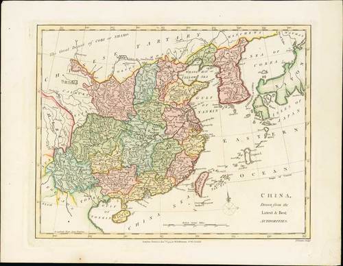
1794 China, Drawn from the Latest & Best Authorities, by Robert Wilkinson; 13½ x 10½ inches, hand-coloured.
Wilkinson's map covers China in full as well as Korea, Formosa (Taiwan), and parts of adjacent Japan, Tibet, Vietnam (Tonkin), and Tartary (Mongolia). Colour coding divides China into its traditional provinces. The Great Wall of China is also identified. Between Formosa and Japan a large island identifies as Liqueo Island is rendered. This is most probably a mismapping of the Okinawa in the Ryukyu Archipelago (of which Liqueo is a failed transliteration). This map was engraved by Thomas Conder and issued as plate no. 39 in the 1792 edition of Robert Wilkinson's "General Atlas".
On stout wove paper, fine. Photo
Estimate
SG$500 to SG$600


