Auction: 15040 - Antique Maps sale during the International Exhibition
Lot: 47
Maps
China
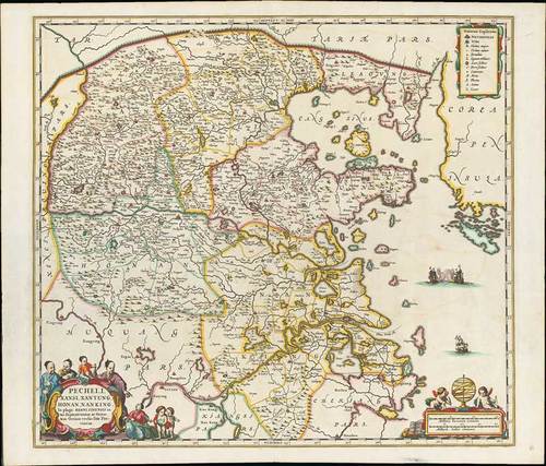
1680 (c.) Pecheli, Xansi, Xantung, Honan, Nanking, by Jan Janssonius; 20¾ x 18¼ inches, old coloured on laid paper.
In "Plaga Regni Sinensis in ter Septentrionem ac Orientem Ceciam versus sitae Provinciae". This highly decorative map of north-eastern China and Korea, published in one of the last editions of Jan Jansson's "Atlas Major".
The massive Great Wall of China forms the northern border and the important salt flats are graphically illustrated along the coast; Beijing assumes the name Xuntien and Shanghai is named Sungkiang. The title cartouche is in the very distinct auricular style favored in the Netherlands and is flanked by Chinese Mandarins. The other cartouche, containing the scale of miles, is surrounded by cherubs or putti. Three ships sail in the sea between China and Corea (Korea), which is noted as being a peninsula, two are at battle with each other.
Central reinforcement and a few minor wrinkles and a short tears or splits in the upper and lower margins. A good example of this important map. Photo
The map is based on the groundbreaking work of Martino Martini (1614-61), a legendary Italian Jesuit missionary and scholar. Martini arrived in Peking in 1644 just as the Ming Dynasty fell to the Manchurian rebels (who formed the Qing Dynasty).
Following in the footsteps of his fellow Italian Jesuit Mateo Ricci, Martini sought out the very best maps and surveys of the Chinese Empire. He compiled a series of maps that were by far the most accurate depictions of China to date.
Martini’s suite of 17 maps was first published by Joan Blaeu as the "Novus Atlas Sinensis", which accounted for volume 10 of his Atlas Maior (Amsterdam 1655). The present edition of one of the most important maps was issued shortly thereafter by Blaeu’s rival Jan Jansson.
Estimate
SG$2,000 to SG$2,500


